Monday, June 04, 2012

109 miles on The Ratchet

 Friday evening around 5pm  the UPS guy finally brought the bike.  Thanks to all of the people who helped me win this bike that I would not have otherwise.   Now I had a decision to make.  Get it built up and ride it for the Fletcher Flyer on Sunday,  or ride my Bianchi.  I had a goal of a sub 5 hr ride, and was concerned about the myriad of things that could happen by riding new equipment.  You just never know.

So, I took the bike to Liberty Bicycles and we set to the task.  Some heckled and some helped, but thanks to the guidance of David Wood, we got the thing build and ready to roll.   When I got home at 7:30pm, it was still light so I kitted up and rolled out.  4 miles around the neighborhood, some minor adjustments, and I was feeling good.  I go home and put it out to my FB friends.  The Foundry or the Bianchi?   100% said the Foundry, so I rolled with it.  It is what I wanted to do deep down anyway, and I tend to live on the edge.  Par for the course. 
So, after another short ride on Saturday, I rolled out Sunday with 900 friends to ride around the flattest course in WNC.

I kept a steady, mellow pace and was surprised that the fast guys/gals in the front were not going hard yet.  I was within reach of my goal but still had 85 miles to go.  We rolled past Smiley's Flea Market and the down Rugby road.  When we made the turn past rest stop two,  I made a decision that would make my goal more difficult to reach.  I stopped for water.  But, I drink a lot of water, and knew that if I ran out, I might not finish, so I stopped and the group rolled on. 

I got a quick refill and pedaled on, fairly soon a small group caught me and though there was some surging, I decided to stay with the group to conserve energy.  While friendly, this group was just below my personal skill level, so I would pull for a while, drop back while our pace slowed, rest up, then pull the group up to my pace again.  At rest stop 3,  I filled up quickly and pulled out.  That is when I met Mike.  He moved here from Idaho last March and is getting used to riding in the mountains.  We didn't talk much as I was on  a mission, and he was convinced that if we pedaled faster, we could catch the fast group..... he didn't know the likes of Wes Dickson, the Pisgah crew, and Chris Strout were in that group.  It was nice to be riding with someone of similar skill level and we put our heads down and pedaled.  We traded pulls evenly, each taking long pulls until we found ourselves back in downtown Brevard. 

Crap, we missed the turn.  We wasted about 5-10 minutes trying to figure out where we were, and finally got back on course.  I would later find out that as we had been in no man's land for a while between fast groups, the fast groups behind us, got past us while we were lost.  We finally got back to rest stop 4, filled water bottles and got going. 

After a few minutes, we were joined by a handful of other guys, again, a group that was just below my target pace, but better than being alone.  I ended up on the front a lot, spending more valuable energy, but I went with it and conserved energy when I could. 

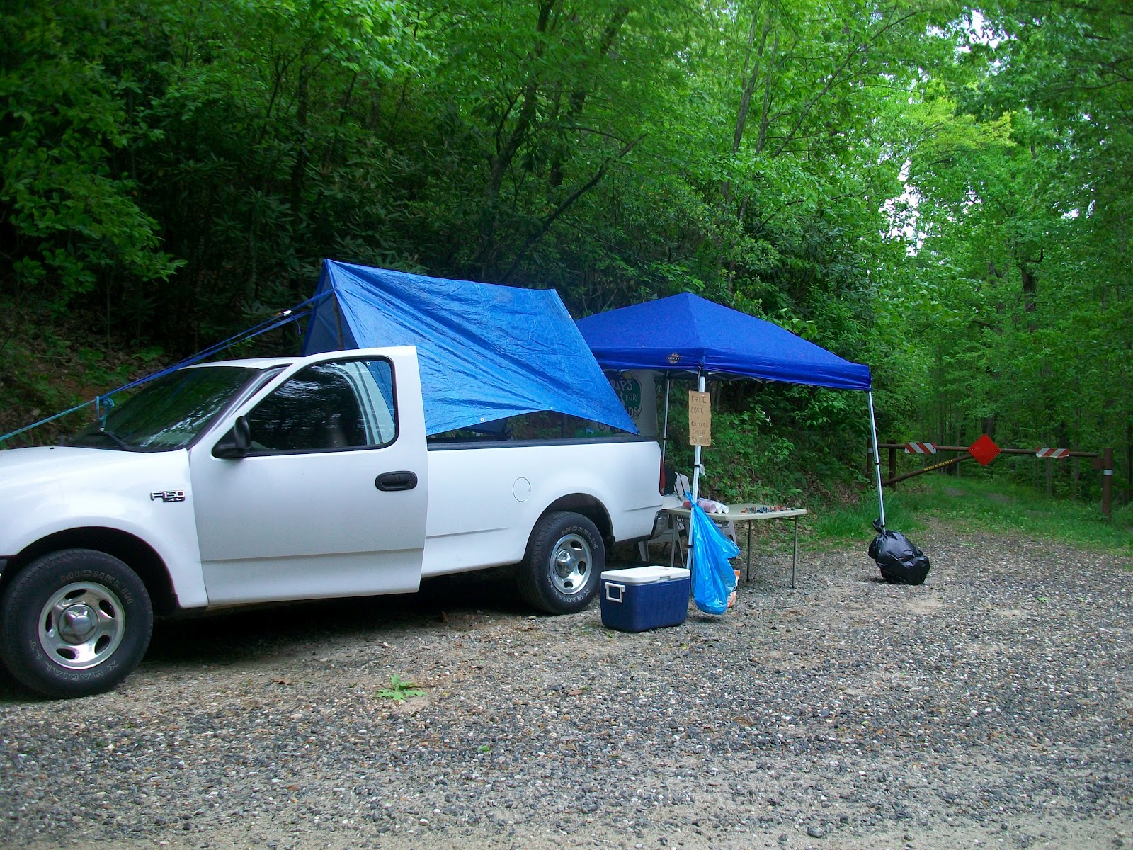
The weather could not have been better, ok,  maybe 5 degrees cooler,  and the service at the rest stops was excellent.  I was able to get in and get out, and by the end of the ride, only accumulated 9 minutes stoppage time. 

Rest stop 5 I filled one bottle with Claudia's sweet tea, found a tree, then got going again.  The group I was with lingered so I sat up for a few minutes so I would have some help on the flats coming up. 

The group was starting to get tired and it showed.  People would sit up, not pull through, look around as if setting up for a sprint... grrr.    Such a simple concept of pulling through, yet so difficult to execute. I guess it is easier to take a free ride. 

Rest stop 6 came up and I stopped for a handful of potato chips.   Combined with the sweet tea, the salty chips and being on part of the Thursday night ride loop, I put my head down and went for it.  A brief draft behind a motorcycle some green lights and I was on the home stretch.   I put my head down and pedaled hard.  I had paced myself well and felt good enough to drop my riding buddies and head for the finish alone. 
At the finish, Rhonda and the kid were waiting for me, the kid riding across the line with me.  Fun times.

My total time as 5h 20 m,  with only 9 minutes off the bike.  I'm sure with some more help, I could have broken the 5 hr mark.  Maybe next year!

Monday, May 21, 2012

GNAR

 So, after nearly pushing myself too far on Saturday at the P111K,  we slept in on Sunday to start the kid's 8 yr birthday celebration day.  He would later sum the day up by calling it " The best birthday present ever"!

After a hearty strawberry pancake and bacon breakfast, we headed out to Camp Pinnacle for GNAR,  the gnarliest kid's adventure race ever.  The elements had not advertised so we did not know what to expect, other than a huge slip and slide and we needed our bikes. 

We arrived at the venue, checked in and walked to course.  The kid was soaking it in and I was excited to share my race knowledge with him.
 At the start line, with  8 minutes to go, I shared with him my techniques for calming amidst the chaos.  We were right next to a nice lake which is what we chose to focus on,  I pointed out the small things that made the lake beautiful and we found some chill space for a few moments in time.
 Then it was 2 minutes to go, and finally we went,  hard.  A sprint for a 1/4 mile to the belly crawl,  I seriously thought my body was going to give out, but there was no way, I was going to make the team slow down.  Skin tingling and lungs burning we dove onto the hot dry grass and hopped onto our bikes.
Suddenly, even though my heartrate was way too high, I felt comfortable,  I was in my element and I could relax.  The mtn bike section was a long grassy climb to double track that dumped us onto a long swoopy downhill finishing on the pump track....awesome.

 We dumped our bikes and headed into the woods, traversing the climbing wall, and then to the rope swing, balance beam, target shooting, hoop throwing, tightlining fun times.   Coming out of the woods, we were excited to get into a boat.  There was a time when I was ACA whitewater canoe and kayak certified, and it had been a while since I had been in a boat.  It came back quickly and we were greeted with cheers of excitement as we slid through the water.   The kid did a great job in the bow, executing a perfect backpaddle to get us turned around to head back to the dock.

 Out of the boats, the course took us up the hillside,  through a cabin and onto the slip and slide for the finish. We dove and slid like nobody's business under the finish banner. 

Airborne
 After the race, no results were posted until the awards ceremony.  We hung out with the rest of the families at the camp, swimming, sitting in the shade and eating some BBQ.  I was cooked and enjoyed the down time, chilling with the fam. 
The awards ceremony was a bit nerve wracking, and although we knew we were fast, we had discussed earlier not to get hopes up and count on a medal if we didn't know for sure.  Yet, finally, they called out," with a time of 16m 23 sec for First place in the Adult/Child category: Lazer Penguins ( the kid's choice for our team name). 

I'm proud of my kid.
(thanks to the wife for taking photos)
We'll be back next year!

Saturday, May 19, 2012

I rolled out of bed at 5am to start eating some food and drink some coffee.  I was excited about the challenge ahead and tried to ignore the nagging sinus crud that I had been struggling with for a week.  I had been taking meds to try to kick it, and was feeling funky.   I got the bike lubed and loaded and headed down the road, nibbling on a 560 calorie honey bun. 


I stuck to my plan and held back at the start.  After about 20 miles, I usually warm up and find a groove, but that never happened today.   I kept focusing on my form and being smooth, but it just was not happening.  I wasn't done yet though and rolled  in to the first rest stop determined to finish. 

The next several miles was spent contemplating yet another DNF.  I have quite a few on my resume and of course don't want any more but a guy has to know when to call it quits.   But,  I wasn't ready to throw in the towel, so I kept eating and drinking holding a steady finishing pace. 

I got to rest stop 2 refueled, greeted the wife and kid and headed out for a loop in Mills River Valley.  It was fun but I noticed that I was getting slower.  I continuously went back and forth, reasoning and weighing the decision. 

My conclusion was that I felt like I could finish.   It would take a very long time, but it could be done.  The clincher was that I was signed up to race as a team with the kid at a kid's adventure race on Sunday.  If I had not had any responsibilities and could have laid around all day, it would have been different.  So I pulled the plug. 

I ran out of water and rode the last 45 minutes hoping that I would make it to Yellow Gap where the family was waiting.  I rolled up and stopped and explained my reasoning. They both agreed.

We packed up and headed to the finish before heading home.

52 miles in 6 hrs 16 mins,  not super fast, but not too shabby either.  It was a good day in the woods and I am pleased with what I did.

Thanks Pisgah Productions for putting on  such a stellar race!!

Friday, May 11, 2012

ABRC/ Liberty Ride

We rolled out hot and heavy, cruising down the parkway with not much of a warm up.  Someone on the front drilled it and we were flying.  We were riding all the way to 191 because it appeared that someone influential complained to the park service and now there are signs prohibiting us from crossing over the Mtns To Sea Trail.  The reroute is a little longer, but not more than 10-15 minutes. 

I sat up and waited for a few people who got dropped.  I was unmotivated and wanted to enjoy the ride, not arrive home totally depleted.  A few of us decided that we would form a B group so the ones who wanted to hammer, would not have to wait for us.  

The sun was bright, the trees and vegetation a deep dark green.  I pulled, I drafted, I got lost in thought.  I've been spending a lot of time being introspective lately.   Getting in touch with who I am, what I am capable of and what I want to do.  It is a topic I visit a lot,  each time defining myself a little bit more and becoming more confident in who I am.  The difficult side of the conversation is admitting what I am not good at.  Letting go of the pride that tells me that I can do anything.  There are simply some things that I cannot do well, or even do at all.  I can try, and if life requires it, I can survive, but I will not be building my profession around said skills. 

And once I accept what I am not good at, the path in front of me becomes more clear, and I am able to move ahead with an irreplaceable confidence.  When I come to those conclusions, I also realize that I begin to enjoy life more. 

As we turned onto Hendersonville rd, the sun was dipping behind the trees.  The air was a bit cooler and the cooling sweat felt good. 

I took one last attempt at a breakaway before turning onto the parkway.  I got lucky at the group got caught at a red light.  Victory at last.....

Eric White made the turn to ride north on the parkway with me.  A little chatting followed by me tucking in behind him as he pulled me the rest of the way home.  

Friends are good to have,  and be.

Thursday, May 10, 2012

Rain Ride

I set out, knowing that there was a good chance I would get rained on, so I packed arm warmers and rain jacket.  It was going to be one of those rides.  I have not had a proper rain ride yet in the past 6  months and I figured I had better get out and ride in a good downpour to get comfortable with it.  The P111K is coming up and, well it is spring so there is a real chance it could rain.  I want to be ready. 

I don't have any aspirations of winning the race, it is going to be grueling and long, but I do have a goal of finishing and feeling good. 

As I arrived at the Arboretum to access Bent Creek the deluge started.  As I filled my water bottle, I considered turning back because it was a little chilly as well, but I pushed on.  The roads were soaked, and my glasses fogged up.  The glasses I had were not the ones I normally where when mtn biking and I'll never wear them again.  They were not at all anti fog and I could not see.  But if I took them off, on the gravel decents , eyes sucked in mud and sand. 

As I made my way up, down and around South Ridge Rd, it happened.  I got frustrated and very glad that I had done this ride in the rain.  Chainsuck.  My chain sucked up into the frame causing me to come to an abrupt stop, barely backpedaling in time to release the pressure and the chain and start pedaling again.  It was then that I remembered the chainsuck from last fall, the last rain ride I had done. 

I cut the ride short, heading home and to Liberty Bikes to overhaul the drivetrain.   New chainrings, chain and bottom bracket and the bike is ready to fly. 


Wednesday, May 09, 2012

PMBAR

I had the privilege again this year to police FS 50515 at the Pisgah Mountain Bike Adventure Race.   Once again, I set up shop to serve grilled cheese and cold cokes.  I was prepared with 20 loaves of bread and 200 cokes.  Last year I had half that and ran out.  This year, I was on the path of a checkpoint that was not mandatory, but I was still hoping to see a lot of people. 

It turns out that the route was fairly lucrative,  either that or the rumors spread and people changed their route just to get some of the golden gooey crunchy goodness of a grilled cheese sammy, washed down with an ice cold coke.  

I arrived at 8am and set up.  It was 3 hours before anyone showed up and had me wondering what I was going to do with all the food if no one showed up.  For a brief second, I even wondered if I showed up a day early....

At 11am the first team showed up and teams streamed through until around 4:30 pm, with a few teams trickling through later.  

I was responsible for manning the post until 8pm.  I was relieved when the last team left at 7:30pm.  They had some trouble with a flat tire, and didn't have what they needed to re-repair the tire, so they were bailing and asked for a ride.  Fortunately, some spectators showed up and they were able to get rolling again.  

At 8pm on the dot, I called it a day, considered heading to the finish, but headed home. 

On Sunday, I was to go for a 65 mile ride with the Fletcher Flyer Training Program and I was tired.

See you next year!

Tuesday, May 08, 2012

Kitsuma

 I got to go for a ride today.  It was good to get some fresh air and clear the head.  It brought clarity,  rides do that for me.Knowing what I need to do and doing it are two different steps, but once it is done it tends to feel better.  Although when the task involves exposing personal feelings and beliefs, with the chance of rejection increasing, the task can be more difficult.  Here's to hoping for the best,  and that is what motivates me now, hope.
I headed out to Kistuma.  The trail is getting broken in and the deep wheel sucking grade reversals are taming down enough to keep some speed over. There are a few farther down the trail though that need some help. 
The views were amazing, the air humid but cool and the Mountain Laurel is in full bloom.  After spending so much time in Bent Creek and on the road this year, the quiet woods were a welcome change. 
Bombing down Jarrets Creek rd, my tires hardly making a sound on the hard packed sand and gravel,  I rounded a bend and spooked a turkey.  It jumped up, startled and with barely 3 feet between us, we both stood there looking at each other for a few seconds.   The turkey did not fly away as one normally would so I sat and watched it.  It was then that I noticed a little turkey the size of  an orange walking around in the brush on the side of the road. 
Lots going on and rain in the forecast.  I'm signed up to ride the Pisagah 111K.  I hope that my rides can stay consistent up until then..  I have plenty of base and know that I can go the distance, just not sure how fast I'll be going.  But is the weather is nice like it was on today's ride,  slow will be just fine!

Saturday, April 21, 2012

Graffiti

Just another day in the hood:  River Arts District, Asheville, NC.


Tuesday, April 17, 2012

The Movement

It is not just a voting contest anymore. It is a movement. It is not simply an x number of individuals voting for Stephen to receive a new bike. It is a large scale movement, that you do not want to miss out on.

What started as a simple vote contest, has turned into a movement to not only see Stephen get on a new bike, but to show what can happen when a large group of like minded individuals come together for a common purpose, a common goal. Imagine the possibilities. If we can accomplish the task of winning the Foundry Tradesman Contest, we could see all kinds of changes, in our own neighborhoods, across the city/county/nation/ world!!

You are the one to make this happen.

Don't miss out on your opportunity to be a part of this movement: click here, log in using the blue FB button, vote for Stephen Janes and the celebrate your part in making this happen!!

After you vote, I challenge you to share with one friend per day until April 30th when voting ends!

Join the movement.

Friday, April 13, 2012


Day 2 of Going Viral

Thursday, April 12, 2012

Let's Go Viral


Monday, April 09, 2012

Foundry Tradesman Contest

I can be a bit obsessive. Mix that with a competitive drive that came from a broken past and a desire to "do it right the first time", and I am left with an unbridled energy, much like that of a horse that has been spooked by a rattlesnake. Knowing that the best thing to do is slow down and take a deep breathe, but unable to for whatever reason.

And so when I was chosen as one of the 3 finalists and entered into a competition to win a new carbon fiber bicycle, I ran with it. I ran so hard in fact that I lost sight of what is important to me. Not that winning a bike is not important, but not as important as the ones close to me, the ones trying to help me succeed in my endeavors.

At first it was fun, then it felt like I should keep going because I was in the lead, almost as if it were my duty to continue.

Then I started thinking about the other contestants. I was being told that I "deserve" to win this bike, and for that, I am honored and don't take those compliments lightly. But, I don't know that I deserve to win more than the other two Southeastern Region finalists. Patrick uses his bike for work, he is a bike messenger in Charlotte. And the other contestant, Jessica is planning on trying out cyclocross and riding across the country. A new bike with new components would be one less thing, one less expense to worry about.

I'm a relationship person. I love meeting new people and getting to know them. Learning about where they have been and where they are. It inspires me and helps me embrace life more. I also like to help people. More than once in the middle of a race or a ride, I have stopped to help someone with a flat, or to give them a tube. I enjoy helping people succeed.

The Facebook voting contest is not me at all. Badgering people to vote for me. Begging people to vote for me. Annoying even myself by repeatedly posting to vote for me. Its not me.

And so, I step back for a breath of fresh air, taking the time to enjoy what is around me. Enjoy the people around me, the good friends I have made. And if this means losing the contest, so be it.

If I really do deserve to win the bike, then it will happen on its own, and will mean so much more than if I begged and badgered my way to the win. I want people to vote for me because they know me, and appreciate me and know that I will truly be a positive, sold out ambassador for the brand.

I am not saying that I am against this sort of competition, don't read me wrong. Foundry is doing a great thing in helping people get some people on their bikes and I am supportive of that and very thankful for the opportunity. Just the method that I have personally been using, going for the big W is not me.

I'm leaving my name in the hat, and I will periodically post a reminder, but I won't be " all up in your face" anymore. I'm stepping back to enjoy life and look forward to seeing how this plays out.

Sunday, April 08, 2012

Afterthoughts

After getting home and sleeping well, I unpacked and cleaned everything, then laid it out in my living room to dry. It took me 3 days before I finally packed everything up and put it in storage until the next trip. I realized as I was packing up, that I had waited so long to complete the task because it meant that the trip was officially over.

After taking about a week to process my thoughts, I figured it was time to get them down in writing.

When I first started planning the trip 6 months ago, my goal was to complete all of the portions open to bicycles, which would have me finishing the trail at Oconee State Park. Then upon looking at maps some more, I realized that Oconee SP is about 12 miles from the eastern terminus of the Trans North GA MTB route. I started thinking about linking the two and that became my goal.

I had 5-7 days to complete the trip. I misjudged SC and thought that I could to 90-100 miles per day since it would be flat. While I had high hopes, I was ready to adjust plans as needed and just get as far as I could.

My goals changed on an daily and sometimes hourly basis, reassessing where I was and how much daylight I had left.

Looking back at the experience/ adventure, I am satisfied with what I did. I am the first person, that I know of, to ride from Awendaw to Spartanburg and that feels pretty cool. I hope that this develops into another ultra endurance race. I'm sure it can be done faster by those who don't need sleep like I do!

I finished this trip satisfied with my performance, my nutrition, pacing etc. In the past when I finished a trip, there was a longing, like something was missing. This time there is only peace of mind, and a full heart, knowing that I tackled something this big, and looking on down the road with the hopes of one day attempting the Great Divide MTB Route.

So what's next? On tap is TNGA and the Allegheny Mountains Loop. The Allegheny Mountains loop will probably happen first as logistics for getting home from the Western terminus of the TNGA are proving quite difficult. Its not easy to ask my wife and kid to drive almost 5 hrs to pick me up. I'll have to keep working on options.

I hope this trip inspires you to get out and explore something for yourself. And if you have any questions about the Palmetto Trail, feel free to contact me.

Day 5- Brickhouse Rec Area to Spartanburg, SC

Today got hot. Really hot. Like in the 90's hot. And then when I was confronted with with 20 miles of downed tree, it was a slog to get through. The scenery was awesome. Hard to describe but lots of greenery, creeks, animal tracks, turkey hunters ( to keep things interesting). If had a hammock, I would have hung it in the trees and just sat for a very long time. But I trudged on. I was hoping to make it to Croft tonight and needed to keep going. Spin for 10 seconds, stop, unclip, lift bike up and over deadfall, rinse, repeat.... for 20 miles. This section, complete with awesome bench cut and solid bridges, needs some simple chainsaw love.

The forest was green and there was a slight breeze which kept things cool enough to keep riding.
The picture above shows one of the nicer toilets on the route....

I kept riding, and I got hot. I took off my helmet to help keep me cool but I looked terrible.

I finally made it through this section, after going 2-5 mph and was glad to be on some pavement for a while. After refilling water at Sedalia Campground, I headed out on the pavement to head for the Glenn Springs Passage. 15 miles of pavement and I made it about 7 miles before I started getting dizzy. I knew that there would be a church eventually and I found it about 1 mile later. I pulled in and found some shade and waited for the temps to cool down a little.

When I finally got going about an hour later, and after a little cat nap, I arrived at the Glenn Spings Passage.:

Rolling farmlands, mature forests, and the historic town of Glenn Springs highlight this 7-mile passage. As the former site of a popular nineteenth century resort hotel, the Glenn Springs historic district includes 20 buildings within an area of 90 acres. The main parking area is at the historic post office, midway between the southern end and the northern linkage to Croft State Natural Area.

Most notable about the trail is the fact that most of it is on private lands. Local residents have opened their farms and forests to hikers and bikers. Please respect their private property by remaining on the trail at all times.


I was discouraged, hot and tired and really hoping and praying that the 7 miles to Croft would not be like the above picture. I walked a lot of the first two miles, and stuck with it.

When I got out of the woods onto the paved road, this is how I felt.
When I realized that I would be riding on a gravel road the next 4 miles to Croft, my spirits soared...

When I hit Croft Passage, I was elated, and let loose:
The Palmetto Trail through historic Croft State Natural Area connects the city of Spartanburg to the Glenn Springs area in southern Spartanburg County. The 12.6-mile trail enters Croft at the Glenn Springs Passage trailhead and crosses the new 65 ft. Advance America Bridge over Fairforest Creek. Hikers and equestrians follow established trails to the east and north while mountain bikers follow roads to the west and north until all join at Henningston Road. The newly built trail from mile 8.5 to the northern trailhead is truly multi-use and follows ridges, crosses drainages, and hugs Kelsey Creek to the historic Cedar Springs area.

Croft is a historically significant area. Structures from the WWII era can be seen from when the area was Camp Croft, an Army Training Center. A short, easy side hike on the blue blazed spur leads to Whitestone Springs, the site of a resort hotel built in 1902. The northern trailhead marks the site of the militia victory at the 1st Battle of Cedar Springs on July 12, 1780. At the other end, the area around Fairforest Creek shoals became a hub of mills, trading, and political activity in the mid to late 1700s, including the first governmental organization - the Spartan Militia District.


I whooped and yelled, and hit the techy lines, knowing that Spartanburg was near.
The rest of the ride was a blur of singletrack, dumping me into the civilization of Spartanburg's greenway with bike share station. I had never seen one up close but here it was. I rolled into town and called Rhonda, making plans for a pickup that night. I rolled onto main street, not having completed the entire route, but satisfied at my accomplishment. After a giant hamburger at Wild Wing Cafe, I loaded the bike into the mini van for the drive home.

Next: Afterthoughts

Day 4: Columbia to The Enoree Passage

I was up before the sun, and ready for breakfast. I wasn't real hungry but managed to get some food in my body before heading to Wal-Mart to restock my supplies. As I was heading through Columbia, I got off the official trail and made my own way through some quiet neighborhoods. It was too nerve wracking to try to follow the map/trail with traffic whizzing by. Fortunately, I met up with Seth, commuting to work by bike. He is a professor of Oceanography at the university. Super cool guy who guided me the rest of the way to downtown.


I rode by the State House and took a few minutes to reflect on the past, and remember that people everywhere are the same, and we are all looking for answers. We should work together toward that end.
And then it was time to grind some more pavement. The route up 215 was again a battle with logging and gravel trucks but we worked surprisingly well together. They gave me a wide berth when they passed and when there was oncoming traffic, I pulled off onto the grassy shoulder so that they would not have to slow down. I gave them a friendly wave as they went by, hoping that news of a friendly gesture would be passed on to the other truck drivers.

25 miles to the Peaks to Prosperity Passage:

After years of working through the railbanking process, Palmetto Conservation purchased an 11-mile, 200 ft. wide right-of-way from Norfolk Southern Railroad. The rail trail begins on the banks of the Broad River at Alston in Fairfield County and continues west into Newberry County, through piedmont forest, into the towns of Peak and Pomaria, and over 14 wooden trestles that cross Crims Creek.

The first 6.5 miles were opened in 2009 after two volunteers, Charles Weber and Furman Miller, cleared and decked eight trestles. A grant from SC PRT allowed us to deck and add handrails to the 1100 ft. long bridge over the Broad River. The view is spectacular, especially when the bald eagles soar overhead. A PARD grant through Fairfield County provided funds to develop a beautiful park/trailhead at Alston that provides parking, picnicking, canoe access, and camping.


Probably one of my favorite sections of the entire state. One of the only sections that I felt that I could camp safely. Unfortunately, I got here late morning and had plenty of daylight left. This section was a very green and lush rails to trails conversion with lots of trestles. It was cool and I plan to take the wife and kid there someday.


Arriving in Pomaria, I was pleased to find a gas station that sold hot dogs, Gatorade and Coke. I sat down for a quick meal before heading up the pavement to Newberry. I got mixed reports from the locals of how much pavement, but decided that it was between 10-20 miles... a huge difference. Nothing to do but start pedaling, so off I went again.

The hills were still there, but not as big as the ones surrounding Columbia, and the traffic was not as bad either. Around 3pm, I arrived in Newberry and was very tempted by the Holiday Inn Express, but I stayed the course and kept on through town. A quick stop to purchase a 560 cal honey bun for breakfast the next morning and I was rolling again.

Up next was the Enoree Passage:
Twenty-two new miles in combination with the Sumter Passage now creates a continuous thirty-six mile trail through Sumter National Forest, linking Newberry, Laurens and Union counties. Enoree Passage is the name for the combined trail; Sumter will no longer be used.

Beginning at Forest Service Road 379, the trail winds 4 miles through pine ridges and hardwood bottomlands, crosses 2 major creeks, Gilders and Indian, and ties into the Buncombe Horse Trail. From this point to Brick House Campground and the Buncombe Trailhead, trail users will be sharing the Buncombe Trail with equestrian users.

Heading north, the trail meanders through some of the most diverse habitats located on the Enoree Ranger District including a beaver pond, many diverse hardwood drains, and the Enoree River corridor. An 80-foot bridge spanning the Enoree provides a superb view of the river. Three fishing lakes - Macedonia, Sedalia, and John’s Creek Lakes lead to the northern trailhead at Sedalia Campground.


The trailhead was easy to find and about 4 miles outside of Newberry. I was excited to get into the woods again but a little wary when I found several trees down right at the trailhead. The trail was pretty clear for the first 4 miles and mostly free of trees until the Brickhouse rec area, but after 4 miles the trail became a multi use trail used by horses. I'm not against horses, but when the walk on even moist trails, the trail gets destroyed and riding a bike becomes almost impossible. I dragged myself through the next 10 miles of what used to be nice bench cut single track, which I could have completed in 1 hr, but instead it took me about 2 hrs to get to the campground.

I was a little frustrated and very tired when I rolled into camp. I was expecting water, but there was none. A couple of the people camping at the Brickhouse Rec area, donated some water, for which I was thankful.

That night some powerful thunderstorms rolled in around bed-time and I ended up spending about 30 minutes in the outhouses, which were super clean and did not smell bad at all. I was glad about that. After the first storm passed, I had to re-pitch my tarp because a puddle had formed under it. As I crawled in, it started raining and rained off and on the rest of the night.
Next: Day 5- Brickhouse Rec Area to Spartanburg, SC

Saturday, April 07, 2012

Day 3, Lake Marion Passage to Columbia

Lake Marion Passage:
This 33-mile passage of the Palmetto Trail skirts along the high water mark of the north side of Lake Marion. Trail users will enjoy some of the most magnificent vistas in the coastal plain with opportunities to spot abundant wildlife and colorful flora. The Lake Marion Passage is marked with orange blazes from Mill Creek County Park to Sparkleberry Landing, with the remainder being marked by yellow blazes. Much of the land along the trail is open for hunting and users should wear bright colors during big game hunting seasons, which is from the middle of August to January. Because of the trail’s proximity to Lake Marion some sections may be flooded during the wet season. However, these wet conditions add to the beauty of the area with a profusion of wildflowers. Almost year-round the pink, yellow, and blue colors will thrill you with their beauty.


The day started well enough with some pavement, dirt roads, a couple of sausage and cheese biscuits at the cabins on Belser rd and then lots of single track. In fact, today, I would encounter the first elevation induced hike a bike section of the trip.


There was lots more swampland and some unexpectedly ride able trails. I was able to turn the cranks until I arrived at Mill Creek County Park. This park had an awesome campground and in future trips will plan to stay here for the night, but since I arrived around 1 pm, and the temps were around 95 degrees, I decided to take a nap instead.

After my nap, I got back on the bike and things went quickly south. It was still hot, but I was determined to make Columbia by nightfall.

I was now on the High Hills Passage:
The 9-mile segment adjacent to the Wateree River swamp was named after the high, sandy ridges that lie wholly within a geographic region known as the Sandhills of South Carolina. The narrow band of rolling hills in portions of Aiken, Lexington, Richland, Sumter, and Kershaw Counties formed the shoreline millions of years ago. Poinsett State Park, Mill Creek County Park, and Manchester State Forest constitute the southern end of the High Hills.

A multi-use trail for hikers, mountain bikers, and equestrians, the trail is steeped in history. Catawba Indians, Revolutionary War soldiers, plantation owners, traders and travelers of the past have left their marks along the trail.

The above picture shows the trail 1 mile into it. It was now a shared use trail and it appeared as though someone had tilled the trail and I was pushing the bike in 95 degree temps, through ankle deep sand, that had been churned up by horses. I had 8 more miles to go and knew that if I had to push the bike the whole way, I would die, not make it, still be out there pushing, or die. I chose to get off the trail and bush whacked to the nearest paved road. I believe that decision saved my life.

I followed the pavement to Poinsett State Park and The Wateree Passage:
The 7.2 mile Wateree Passage begins in Poinsett State Park and runs to the Wateree River, crossing through Manchester State Forest and along the old SC Railroad bed. The passage is one of the most diverse sections of the Palmetto Trail, traversing a variety of landscapes, from near mountainous terrain down to a magnificent river swamp. After two miles, the trail begins the ascent to the "High Hills of Santee," which is one of the highest elevations in Sumter County. The High Hills provides spectacular vistas of the swamp and Richland County.

Refilling my water I headed up the trail into Manchester State Forest. The next 7 miles was fun. It included some hike a bike, rolling hilly sections that then turned into rail to trail with lots of trestles across swampy land. I enjoyed this section a lot, especially since the temps were cooling. Then I hit the stairs at the end of the section, hiked down into swamp land, followed a fisherman's trail, found a gravel road, went one way then the other. I was lost. This was not on the map, and I followed my gut. I followed my gut right onto the power plant property and out the front gate.
I had failed to bring along a map of SC but fortunately, I was able to call the Palmetto Coalition to figure out where I was.

The next 34 miles were some of the worst of the trip and I highly recommend finding another route into Columbia. 15 miles of HWY 601, with heavy truck traffic was not fun, at all. And then add in a road with giant rolling hills and my progress was slow. I made it safely to Leesburg Rd/ Hwy 262 and turned left towards Columbia. Somewhere along this road, the actual trail enters the woods and parallels the road. I opted for the second time, to get off route and stay on the pavement for the sake of making Columbia before nightfall. Several times, as the sun sank closer to the horizon and the thunderstorms raged all around, I considered turning into the woods to camp for the night, but with a 100 yrd buffer between the paved road and Fort Jackson's training grounds, I was concerned again about my safety. So, I pedaled the pavement. There was still traffic and rolling hills but to a lesser degree.

I eventually arrived at Fort Jackson and took a right onto the property through Gate 5, to follow the trail across the campus. Halfway across the sun set, leaving me in darkness as proud trumpets played Reveille over the loud speakers. I got chills and felt honored to be in that place at that time. Then I heard the troups, somewhere on campus cheering, which brought on more chills.

I got to Gate 1 and onto Leesburg Rd. I asked for directions and found that I was 2 exits down from where I wanted to be. I battled darkness and city traffic to find some hotels.

I got settled in my room, took a shower, ordered pizza and went to sleep, tired.

Next: Day 4- Columbia to The Enoree Passage

Friday, April 06, 2012

Day 2: Lake Moultri Passage to Santee


After a good night's sleep at the local Holiday Inn ( I splurged and the manager had pity on me, giving me the manager's special), I headed out at the break of dawn for another day. I was excited to see what South Carolina had in store for me.

The Palmetto state has brought me a lot of bad memories in the past: puke on a hotel comforter ( someone else's, that we didn't see until we were leaving), a girlfriend who was from SC, who broke up with me, a stolen bicycle.....


I was excited and hopeful that this trip would prove a positive experience, and that I was find some things about the state that I loved and would want to return for. Little did I know I would look forward to another visit.


So, I rolled out of the hotel for 5 miles of pavement before getting back on the trail. I pedaled through the recreation area and made haste to get past it lest the creepy old dude was back, "hanging out".

First up was 24 miles of the Lake Moultrie Passage:

Scenic and with two easy access points — each just a short distance from some remote and beautiful country — it’s still one of the most popular, especially with mountain bikers. The trail rings Lake Moultrie’s eastern and northern shores via service roads along the lake’s dike system. At the southern trailhead (Canal Recreation Area) the trail begins with a short stretch through a pine forest and climbs steps up the earthen Pinopolis East Dike for spectacular views of the lake, especially at sunset. The northern portion of the trail continues along the dike system until you cross the Old Santee Canal on an old railroad trestle. The last few miles of the Lake Moultrie Passage push through a mature hardwood and pine forest that includes some of the trail’s most interesting terrain.


And it was definitely scenic. Double track packed pea gravel, riding along on top of a dyke, next to a huge expanse of water. After yesterday's 5-7mph avg, I was able to get in the big ring some today, and cruise at a speed of 15-18 mph, nice.
Along the above section, I caught glimpses of two 6 ft alligators and a smaller 3 foot one. I also got to see a bald eagle, which really made me happy!Up next was the Eutaw Springs Section, 20 miles:

More than a simple connector trail between Orangeburg and Berkeley counties, the Eutaw Springs Passage of the Palmetto Trail pushes through a varied terrain of grassy pastures, tiny downtown Eutawville and shady dirt roads and past the site of the Revolutionary War Battle of Eutaw Springs.

Although the southern portion of the trail follows rural dirt roads through some unremarkable terrain, the best part of this trail comes closer to Eutawville where you’ll travel through old pasture fields once part of a dairy farm. A spur trail through Santee Cooper Wildlife Management Area is closed periodically in which case, signs will indicate closure and you must use the Palmetto Trail route along Fredcon Road. The trail ends at Eutawville Community Center, close to downtown shops and lots of friendly people.

Followed by 13 miles of The Santee Passage:

Lots of dirt roads and time on rural highways make this a pleasant trip for mountain bikers. However, hikers may have to spend more time in “civilization” than we usually prefer. The 13-mile passage winds through the predominantly agricultural lands of eastern Orangeburg County and uses many “farm-to-market” roads. Meanwhile, the adjacent lands present a tapestry of color and texture with a variety of crops such as cotton, wheat, soybeans and canola. Nearby produce stands offers seasonal delights including fresh strawberries, blueberries and peaches. The pot of gold on this trail is the shady portion across land owned by farmers Ira and Mona Avinger. Take time to enjoy your time in the pine woods and beneath some whopping oak trees. This passage eventually crosses under bustling Interstate 95 on dirt roads and emerges at the tourist town of Santee.


I made it to the town of Santee, crossed the bridge and found a campground for the night. I was excited to be camping tonight, but less excited when the sun set, and the street lights came on all over the campground. Unfortunately for me, the flat tent site that I had chosen, also had two street lights in close proximity. I ended up falling asleep for a couple of hours, with a knee warmer across my face...


Next up: The Lake Marion Passage

Day 1: Awendaw to Moncks Corner


I made it safely to the eastern terminus of the Palmetto Trail and took a moment to enjoy the rising sun before heading off into the unknown. The trail meandered through all types of terrain, burned forests, pine forests, hardwood forests, swampland, gravel/sand roads, single track etc. I was never in the same type of surroundings for long and it was amazing to see the different kinds of flora.
First up is the Awendaw Passage of the Palmetto Trail. From the Conservation web-site:

"The Awendaw Passage is the coastal terminus of the Palmetto Trail, ending at the intracoastal waterway, the "sea" part of the Mountain-to-the Sea Trail. This is also where you'll see palmetto trees along the trail. The trail follows Awendaw Creek through a maritime forest and offers sweeping vistas of the salt marsh. At Walnut Grove, look for a scenic overlook and boardwalk. The trailhead at Buck Hall National Recreation Area provides parking and bathroom facilities for trail users".
In addition to being extremely well marked, bridges and boardwalks have been built at most river, creek of swampy crossing.

After 7 miles the trail enters the Swamp Fox Passage:

A 47-mile journey through four distinct ecosystems, the Swamp Fox Passage is currently the longest section of the cross-state trail. There are three trailheads, which means you can either do the trail as a three or four-day trip or in shorter sections. Any access point makes for an enjoyable trip and diverse views.

My goal was to complete this section on day one and then some. About 20 miles into the trip, I realized that I had underestimated the difficulty of the terrain. I was expecting little to no elevation change, and in that I was correct. What got me was the actual trail. Mostly single track, I can only liken the conditions as riding through my back yard, for 47 miles. The trail was grassy and well kept but bumpy with no coasting down hills. This meant that I had to pedal, constantly in order to make progress. I was moving along at 7-8 mph avg, and less at times. I stayed optimistic, but realized that I was going to have to reassess my daily mileage goal.
Around mile 36.5 I was planning on stopping at the Witherbee Ranger station and hoping there was a Coke machine. This section is remote in that there are no towns/gas stations near the trail. I was glad that I had packed extra food and did not need to rely on re-supply for this section. When I arrived at the ranger station, it was deserted, so I filled up on water, behind one of the buildings, and hit the trail again.
There is a cool little, remote campsite to the right of the above picture that I highly recommend. It is Cane Gully. Interestingly, I crossed paths with Dane, the guy responsible for the Palmetto Trail, and he was planning on camping here tonight. I was tempted to stay and enjoy the company, but it was mid afternoon and I wanted to get some more miles.

I decided to get to the end of the section, the Canal Rec Area, and set up camp there for the night. The map said there was a campground, and water. When I got there, I found an overgrown picnic area with half burned outhouses, and I immediately knew that this would not be a safe place to spend the night. I headed to town and found a hotel for the night. It was well worth the money spent, to get a good night's sleep.

Next up: The Lake Moultrie Passage

Thursday, April 05, 2012

The Palmetto Trail

I can't remember how I stumbled on the Palmetto Trail in South Carolina, but I did. Somehow it found me, and things worked out from there. I can't explain it, and won't attempt to, it kind of makes sense to me, and the mysteriousness surrounding it, is good enough.

So, I spent quite a bit of time researching, googling, printing and studying maps, etc. Doing everything that I could to be ready when the right time came for me to go. And the suddenly, it appeared as if the window was opening. The preparations continued. I packed and repacked. The week before I went, Rhonda helped me sew a new lightweight sleeping which I posted about earlier, and the day before I left, Liberty Bicycles got a shipment of the new Salsa/Revelate Frame Bags, one of which fit my bikepacking bike perfectly.... I made the purchase, swapped out my Tangle Bag, and repacked. It was great to have the little bit of extra room.

Friday morning rolled around and I got the wife and kid off to school, then rolled out to Park Ridge Hospital to meet my ride. Haley and Jamie were kind enough to offer me a ride, since they were headed to Charleston. On the way down, we passed a huge wild fire and the reality of the danger for me riding the trail with wild fire threats became more real.

We rolled into Charelston to be greeted by police officers at every intersection, directing traffic. It was the annual Bridge Run weekend and the city was expecting 40,000 runners. I was tempted to stick around to see the crowd, but decided not to.

They dropped me off and I made my way through the city, over the bridge and out to my campsite for the night. I stopped by the Trek Concept Store to say hey to Ben Gruber.


The site was on private property and I had made previous arrangements to get permission to camp there. When I got there I introduced myself to one of the housemates and then went to eat at Sewee Restaurant. It was a cool little seafood shack and under other circumstances, I think I would have enjoyed my meal, but I was excited and my stomach was doing flips, so I only ate about half of my shrimp.... it was hard to leave them on the plate. I got back to the campsite, and set up my tarp by the time the sun went down. Then I laid down to get some shuteye. I finally fell asleep only to be awakened by a bright light shining in my face. Apparently, N did not get the message that I was camping in his yard:

Me: Hello
N: Who are you?
Me: I'm Stephen, who are you?
N: I'm N, the dude that lives here.
Me: Oh, talked to E on the phone and he said I could camp here, I'm on a cycle tour, and I talked to R earlier and she said that I could set up here.
N: Dude, you dropped all the right names, have a good night, enjoy yourself.

It took a little while to go back to sleep but I did. I woke up around 5am and started getting packed up, heading 100 yard up the road to the Sewee Outpost to get some coffee and a couple of biscuits. I got one for the road.

The plan was simple, ride the pavement, four lane Hwy 17 north, for 15 miles to the trailhead, then start riding the trail. I was thinking that with 13 hrs of daylight, I should be able to ride 80-100 miles for the first couple of days. The Palmetto Trail was about to teach me a lesson.

Next: Day 1 of the ride.

Foundry Bicycles

Well, good news. I have been selected as a finalist to be a tradesman for Foundry Cycles. If I win, I will have the opportunity to choose one Foundry Bike, and ride it, representing the company. It would be an honor to win, and I would be even more honored if you would vote for me, using this link: http://foundrycycles.com/rideforfoundry/#southeast

Thanks